We can’t send you updates from Justia Onward without your email.
Unsubscribe at any time.
Lately, Google and Yahoo have been unveiling competing products in a battle for Internet users. After one company unveils a new offering, the other will often come out with a similar product shortly thereafter. Well,...
Lately, Google and Yahoo have been unveiling competing products in a battle for Internet users. After one company unveils a new offering, the other will often come out with a similar product shortly thereafter. Well, it appears that Microsoft is looking to join into the fray – and I’m not talking about the dueling lawsuits between Microsoft and Google over Kai-Fu Lee.
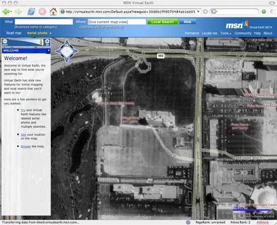
The latest battleground involves satellite maps with Microsoft releasing a beta version of MSN Virtual Earth over the weekend. I really like the overlay of street names and landmarks over these images.

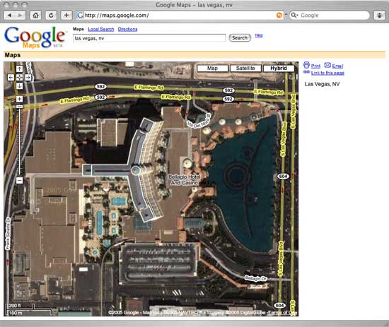
To no surprise, Google Maps now offers this feature as well. I’m not sure who was first and who was second, but congrats to both. In Google, the hybrid button triggers the overlay of the map onto the satellite image.

The big difference between the two images – besides the fact that one is in black and white and the other is in color – is that although both maps include a label for the Bellagio Hotel and Casino, only one of them actually displays the Bellagio. Considering that the Bellagio opened in 1998, that should give you a hint of the vintage of Microsoft’s satellite images. So, if you are leaving for Las Vegas, stick with Google for now.
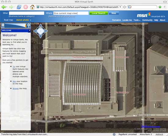
However, MSN Virtual Earth isn’t without its merits. For selected locations within featured cities (that’s just a polite way of saying for isolated localities), Microsoft offers much higher resolution images. Here’s a view of the World Bank in Washington, D.C., home of Paul Wolfowitz.

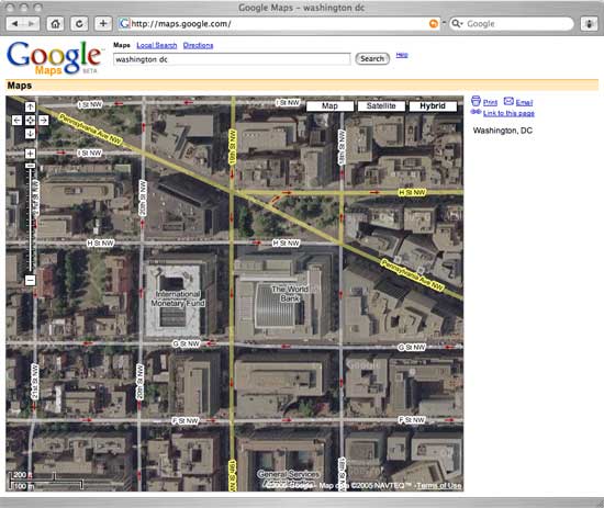
In Google Maps, the degree of resolution is much lower. Did you notice that both maps identify which streets are one-way?

Google takes first place by a wide margin. Google Maps feature fresher satellite images and higher resolution images for more areas, including international destinations. MSN Virtual Earth takes second place. However, it should really be called Virtual USA and not Virtual Earth. For selected cities, Microsoft offers higher resolution images. However, these images are not available for many parts of the USA. Also, because Microsoft relies on the US Geological Survey for its images, the Virtual Earth feature doesn’t includes close-up satellite images of Europe, Asia or even Canada. Still, I imagine this is just a first step for Microsoft and that it will spend its way to bringing forward a more competitive product in the future. As for Yahoo, I’m surprised that they hasn’t upgraded their maps to be competitive with Google and now Microsoft. That may just be a timing issue. We’ll have to wait and see.
